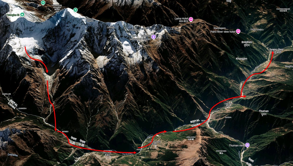
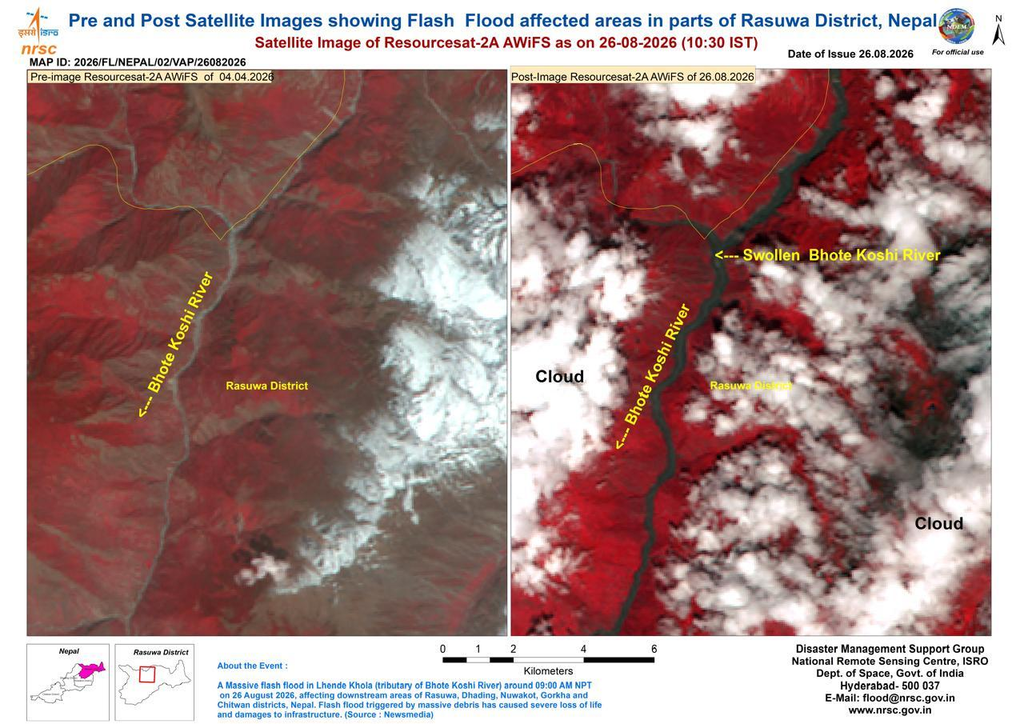
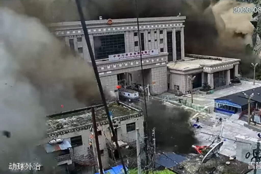
On the morning of August 26, 2026, a chunk of ice and rock broke off the Langtang Lirung, a 7,000-metre (23,000ft) peak near the Nepal-China border. It set off an avalanche that ripped through the Bhotekoshi and Trishuli rivers, carrying water, ice, mud, and rock with it. Villages, roads, bridges, and the Gyirong Port trade crossing were destroyed.
The location of the collapse helps explain how the disaster spread so quickly. The slope gave way high inside Langtang national park near the China border. Ice, rock and debris then rushed down a steep narrow valley and entered the Lhende khola river. The valley pushed debris and floodwater downstream towards populated areas. The flow travelled nearly 100 KM through the lende Khola and trishuli river system, according to the US Geological Survey.
The death toll now stands at 903, with more than 4,200 people still missing, according to Nepal’s National Disaster Risk Reduction and Management Authority.
The collapse also blocked a river and created a new lake, which started overflowing two days later. One disaster triggered a second.
For India, the flood raises an uncomfortable question. The country has thousands of glacial lakes sitting in unstable mountain terrain of its own. How prepared are we?
What Actually Went Wrong in Nepal
Glacial lakes form when melted ice collects behind a natural wall of rock, ice, or loose debris left by a retreating glacier. Most of these lakes sit quietly for years.
But an avalanche, a landslide, or even heavy rain can push too much water against that wall. If the wall gives way, the flood that follows moves fast and carries mud, rock, and debris with it. Scientists have a name for this: a Glacial Lake Outburst Flood, or GLOF.
But in Nepal an old lake did not suddenly burst. A massive avalanche blocked the river and created a new lake within hours. Scientists had no years of data to monitor it. That makes such events much harder to predict.
“Based on the preliminary information available so far, the flood appears to have started with an ice avalanche in the upper Lhende Khola near the Nepal-China border. A large volume of ice and rock entered the river and pushed water, sediment and large boulders downstream,” said Dr Saswata Sanyal, disaster risk reduction specialist at ICIMOD.
“The detailed assessment is still ongoing, so we cannot yet confirm the exact trigger,” Sanyal added. “That much we can assert now. It is not a glacial lake outburst flood. It was an ice avalanche,” Sanyal said.
Just five months earlier, the ICIMOD had published two reports Changing Dynamics of Glaciers in the Hindu Kush Himalaya Region from 1990 to 2020 and HKH Glacier Outlook 2026: Insights from 50 Years of Himalayan Glacier Monitoring—warning that glaciers across the Hindu Kush Himalaya were melting twice as fast as they were in 2000.
The reports warned that some parts of the Himalayan cryosphere—the part of the Earth’s system where water is in solid form, including ice, snow, and permafrost—could be nearing irreversible change.
Researchers are still working out exactly what caused the Nepal flood. Glacier retreat, thinning snow cover, and thawing permafrost are all on the list of possible triggers.
Dr. Mohd. Farooq Azam studies the cryosphere at the ICIMOD. He said existing lakes aren’t a mystery.
“Glacial lakes can be seen with our eyes and through satellite data,” he told Ground Report. “We can assess whether the lakes are potentially dangerous or not.”
At the same time, he added that these disasters are difficult to predict, and “the whole Himalaya is susceptible to such disasters.”
How Exposed Is India, Really
India’s mountain states Sikkim, Arunachal Pradesh, Uttarakhand, Himachal Pradesh, Ladakh, and Jammu and Kashmir sit on top of thousands of glacial lakes.
The Central Water Commission currently tracks 2,485 glacial lakes and 358 other high-altitude water bodies larger than 10 hectares. A government assessment in 2025 marked 56 of them as “very high risk”.
Researchers at the University of Kashmir, in their study published in the Journal of Glaciology early this year, mapped 155 glacial lakes across the Kashmir Himalaya and found that lakes touching glaciers had grown 26% since 1992.
Five of those lakes were flagged as especially dangerous, threatening thousands of buildings, 15 bridges, and a hydropower project downstream.
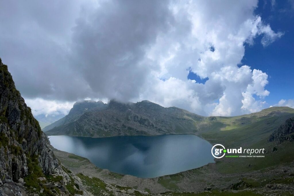
As the United Nations University notes, the risk also depends on how strong the natural dam is, how steep the slopes around it are, and what lies downstream if it breaks.
Azam said India can already use its inventory of known lakes to plan ahead. What’s missing is a clear inventory of where sudden rock and ice avalanches are most likely to strike. “If you want to know the hotspots for rock and ice avalanches, that inventory we don’t have at the moment,” he said.
“One hazard can trigger another in the mountains. In this case, an ice avalanche triggered a flash flood downstream,” Sanyal said. “We are seeing more of these interactions between different hazards in mountain areas, and we need to understand these chains of events better.”
India Has Already Lived Through This
In October 2023, South Lhonak Lake in North Sikkim burst and sent water crashing down the Teesta Valley, destroying homes, bridges, roads, and the Chungthang hydropower project.
In February 2021, a sudden flood tore through the Rishi Ganga valley in Uttarakhand’s Chamoli district, killing hydropower workers and wrecking infrastructure. Investigators later traced it to a massive rock and ice avalanche, not a lake failure.
And in 2013, extreme rain, landslides, and the outburst of Chorabari Lake combined to flood the Mandakini Valley in what became the Kedarnath disaster. India’s National Disaster Response Force still lists Chamoli and South Lhonak among the country’s worst glacier-related disasters.
“Every disaster is unique,” Azam said. “It depends on the local topography. It depends on what kind of mass movement is happening.” The same hazard can mean almost nothing in an empty valley and everything in a valley with people, roads, and power plants in it.
Gap Between Planning and Doing
India’s National GLOF Risk Mitigation Programme launched in 2024 with Rs 150 crore in funding. It has identified 195 at-risk lakes and sent field teams to 40 of the most dangerous ones, Safi Ahsan Rizvi, a former advisor to the National Disaster Management Authority, wrote in The Wire.
But identifying a risk isn’t the same as watching it. Of those 195 lakes, only three have automated weather stations actually tracking water levels in real time.
“For GLOFs, we have the science, the satellites and the funds,” Rizvi wrote, “but in the mountains, a financial year or a utilisation certificate holds no meaning. One missed season lets a lake grow for another 12 months, raising the risk more and more.”
Azam said some mountain failures build up slowly, giving scientists time to catch warning signs. Others happen in minutes. Either way, he said, India can’t stop at watching known lakes. It needs to understand which slopes are unstable, map where floodwater would go, and know exactly who lives in its path.
Support Us To Sustain Independent Environmental Journalism In India.
More Ground Reports
He Was Married as a Child, Now Manish Dangi Helps Stop It for Others
Despite The Ban, How Gutkha Became MP’s Most Common Household Habit