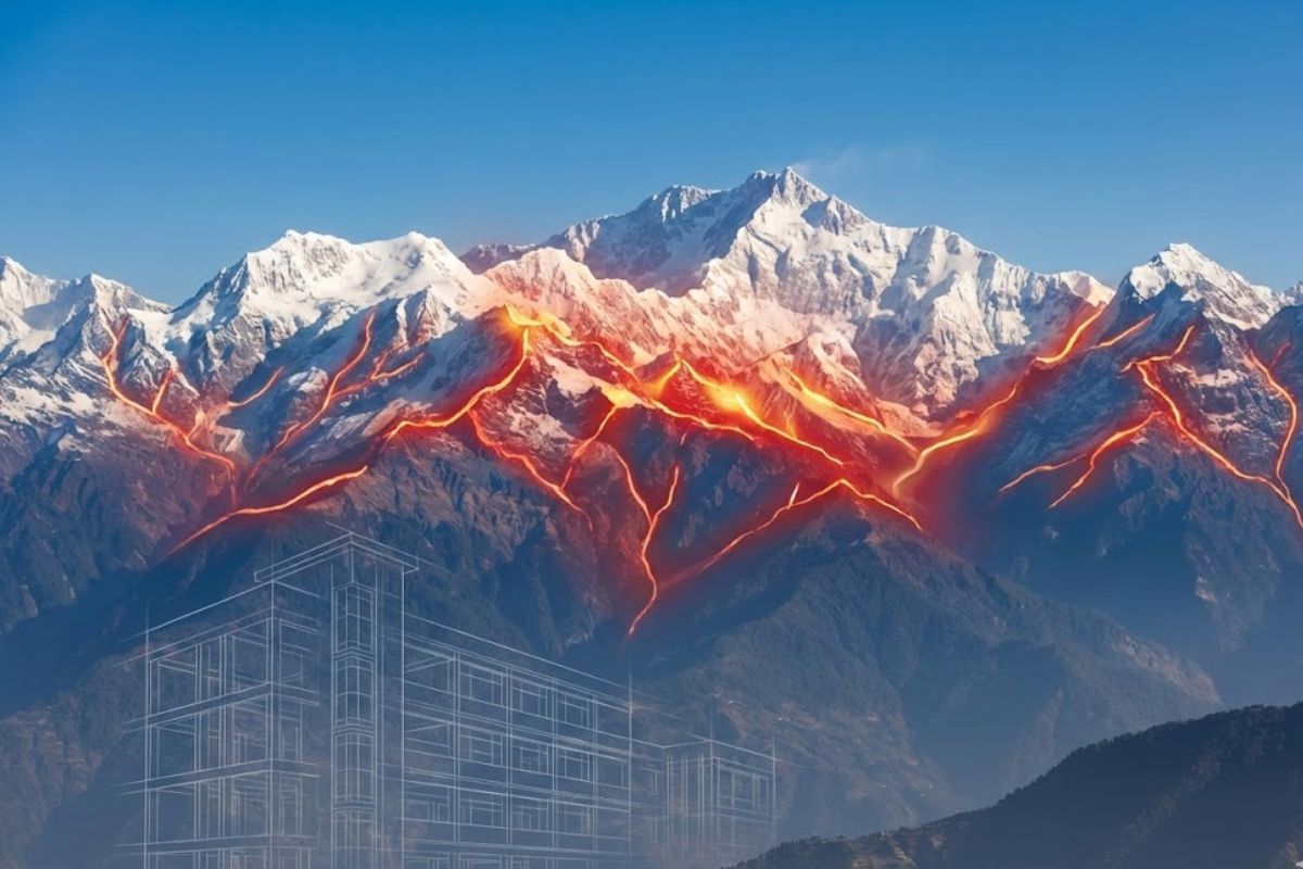
India just released a new earthquake map that changes everything we knew about earthquake safety. The entire Himalayan mountain range is now marked as the most dangerous zone for earthquakes in the country. This is the first time this has happened.
The Bureau of Indian Standards, a government body that sets safety rules, released this new map last week. They created a brand new risk level called Zone VI. This is now the highest earthquake danger rating in India. Before this, Zone V was the highest.
The map shows that 61 out of every 100 square kilometers in India are now in medium to high earthquake danger zones. That’s more than half the country. All the Himalayan states like Jammu and Kashmir, Himachal Pradesh, Uttarakhand, Sikkim, and the northeast states are in Zone VI. The Andaman and Nicobar Islands are also in this highest danger zone.
New zone classification is as follows:
| Seismic Zone | Hazard Level | Meaning | Regions (Typical Examples) |
| Zone II | Low | Light shaking expected | Central India, parts of South India, MP, Rajasthan |
| Zone III | Moderate | Noticeable shaking | Mumbai, parts of north Odisha and Jharkhand |
| Zone IV | High | Strong shaking possible | Delhi NCR, Kolkata, Patna, Gandhinagar |
| Zone V | Very High | Very strong shaking | Eastern Ladakh, Himalayan foothills |
| Zone VI (new introduction) | Extreme | Great earthquakes (M8+) possible | Entire Himalayan arc: Kashmir–Himachal–Uttarakhand–Nepal border region–Sikkim–Arunachal |
About 75 out of every 100 people in India live in areas where earthquakes can happen. This new map is not meant to scare anyone. It’s meant to help us build safer homes and buildings.
What Is Zone VI, Why Does It Matter?
Think of Zone VI as a report card that says “very high danger.” It means the ground in these areas can shake very hard during an earthquake. The shaking could be strong enough to damage buildings if they are not built properly.
Scientists created this zone using a smart way of measuring earthquake danger called Probabilistic Seismic Hazard Assessment. This is just a fancy way of saying they looked at how likely an earthquake is and how strong it might be.
The old map from 2016 had split the Himalayas into two different zones – Zone IV and Zone V. Some parts were marked as high danger, and some as very high danger. But this didn’t make sense because the whole Himalayan mountain range sits on the same crack in the earth where two giant land pieces meet.
Vineet Gahalaut is the head of the Wadia Institute of Himalayan Geology. He studies earthquakes for a living. He said, “The earlier zonation did not fully account for the behaviour of these locked segments, which continue to accumulate stress.” In simple words, he means the old map didn’t show the real danger properly.
Some parts of the Himalayas between Uttarakhand and Nepal haven’t had a big earthquake in almost 200 years. This is actually scary because it means pressure has been building up underground all this time. It’s like blowing air into a balloon for 200 years – at some point, something has to give.
How Scientists Made This New Map
The old way of making earthquake maps was simple. Scientists would look at where earthquakes happened in the past and mark those areas as dangerous. But the new map is much smarter.
Scientists now use computers and special math to predict where earthquakes might happen in the future. They look at cracks in the earth called fault lines. They measure how the ground moves. Scientists study the rocks and soil. They figure out how earthquake waves travel through different types of ground.
M Ravichandran is the boss of the Ministry of Earth Sciences. He explained that scientists now have much more information than before. “New observations from additional locations and a significantly expanded dataset allowed the National Centre for Seismology to redraw the seismic profile of the country,” he said.
What he means is that India now has better earthquake-measuring machines called seismometers. These machines are placed in many more locations across the country. They can detect even small movements in the ground and send this information to scientists.
Ravichandran also said the map might change again in about 10 years. As scientists get even better tools and more information, they will keep updating the map to make it more accurate.
The Bureau of Indian Standards said this new map uses the same methods that other countries use. This makes India’s earthquake planning as good as anywhere else in the world.
New Rules for Homes & Buildings
The new map comes with new building rules. If you live in Zone VI areas, any new house, school, hospital, or bridge must be built following these strict rules.
Buildings must be designed to bend but not break during an earthquake. Think of it like a tree in a storm, trees that can bend survive, while stiff trees break. Engineers call this “ductility” but you can just think of it as flexibility.
Here’s something new that nobody thought about before. When earthquakes happen, it’s not just walls and roofs that fall. Ceiling fans, water tanks on roofs, electrical wires, and even elevators can fall down and hurt people. The new rules say all these things must be tied down properly.
If any part of a building weighs more than 1 out of every 100 parts of the whole building, it must be locked in place with strong bolts and supports. This will stop things from falling on people’s heads during earthquakes.
Towns that sit on the border between two zones now get put in the higher danger zone automatically. This way, people don’t get confused and build unsafe buildings thinking they’re in a safer zone.
The rules also talk about something called the “exposure window.” This is a fancy way of saying scientists now look at how many people live in an area, how many buildings there are, and how rich or poor the area is. A medium earthquake in a crowded city causes more problems than a big earthquake in an empty area.
How This Affects Tourism & Travel
Many beautiful tourist places are in the Himalayas. Places like Leh, Shimla, Manali, Dharamshala, Nainital, Gangtok, and Darjeeling are all in Zone VI now.
Don’t worry, tourists can still visit these places. The government is not stopping anyone from traveling to the mountains. But hotels, guest houses, and resorts will need to follow the new safety rules.
Some hotels might close temporarily while they make their buildings stronger and safer. You might see construction work happening in tourist areas as old buildings get upgraded.
For travelers, this is actually good news in the long run. It means the hotels and buildings you stay in will be much safer. When you plan a trip to the hills, you should ask hotels if they follow the new earthquake safety rules.
Tour operators and hotel owners will need to spend money to make their buildings safer. This might make trips slightly more expensive. But it also means families can travel knowing their hotels won’t collapse during an earthquake.
Why Do Earthquakes Happen in Himalayas?
The Himalayas are still growing taller every year. Yes, you read that right – the mountains are not finished yet.
Millions of years ago, the land that is now India was far away in the south. It was part of a super-continent called Gondwana. Then it broke off and started moving north, like a giant ship sailing across the ocean.
About 50 million years ago, this Indian land piece crashed into Asia. When it hit, the land crumpled up like paper and formed the Himalayan mountains. And guess what? This crash is still happening today.
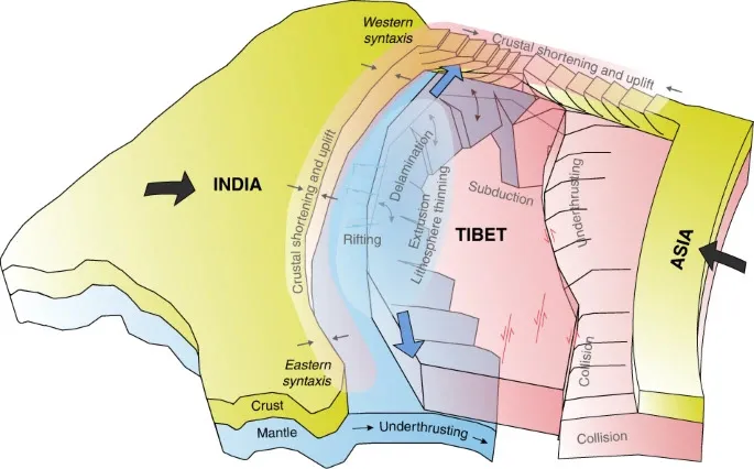
The Indian plate (the ground under India) is still pushing into the Eurasian plate (the ground under Asia) at about 5 centimeters every year. That’s about as long as two thumbs. It doesn’t sound like much, but over hundreds of years, it adds up.
This pushing and shoving underground creates pressure. Sometimes the pressure becomes too much, and the ground suddenly shifts. That’s an earthquake. The place where the two land pieces meet is called the Main Himalayan Thrust. It’s a huge crack in the earth that goes from Delhi all the way to Tibet.
Will a Big Earthquake Happen Soon?
Scientists published a study in October that found something worrying. They said the Himalayas might see two very big earthquakes in the future. These could be 8.8 on the magnitude scale, which means very, very powerful.
The study found that some parts of the Himalayas have been storing up pressure for 500 to 700 years. That’s a very long time. The researchers wrote, “The present analysis with improved geodetic observations and models suggests higher convergence and wider locking width for the Himalayan megathrust, implying an increased seismic hazard.”
In plain language, this means the two land pieces are pushing together harder than scientists thought before, and a larger area is locked together tightly. When it finally breaks loose, the earthquake will be very strong.
But here’s the important part, nobody knows when this will happen. It could be next year, or it could be 100 years from now. Scientists cannot predict the exact date of earthquakes. That’s why the new map and building rules are so important. We need to be ready all the time.
This Is Not a Panic Situation
Some news headlines make it sound like the Himalayas are about to collapse tomorrow. That’s not true. The Himalayas have been here for millions of years and will be here for millions more.
Earthquakes are a natural part of how our planet works. Deep inside the earth is hot liquid rock. The solid ground we walk on is like a thin crust floating on this liquid. The ground moves slowly all the time. Sometimes it moves suddenly, and we call that an earthquake.
Vineet Gahalaut said the new Zone VI label helps everyone understand the danger clearly. It should push government offices, hotel owners, and regular people to check their buildings, make them stronger, and have plans for what to do when an earthquake happens.
The new map is a good step. India now uses better tools, more sensors and stronger data. Scientists understand the ground more clearly and can guide safer building.
Countries that prepare for earthquakes save many lives when earthquakes happen. Japan has earthquakes all the time, but fewer people die because their buildings are built to survive shaking. India is now following the same path.
What Should People Do Now?
If you live in Zone VI areas, here’s what you should do. First, check if your house follows earthquake-safe building rules. If your house is old, you might need to strengthen it. Government programs may help with money for this.
Learn earthquake safety rules. During an earthquake, drop to the ground, take cover under a strong table, and hold on until the shaking stops. Keep an emergency kit at home with water, food, flashlight, and first aid supplies.
Schools should practice earthquake drills. Kids should know where to go and what to do when the ground starts shaking. This practice can save lives.
If you’re building a new house, hire an engineer who knows the new earthquake rules. Don’t try to save money by skipping safety features. A slightly more expensive safe house is much better than a cheap house that collapses.
The new map will make India safer. Better buildings, stronger hospitals, and prepared communities mean that when the next earthquake comes, and it will come someday, fewer people will get hurt and fewer buildings will fall down. This is not about panic. This is about preparation. And preparation saves lives.
Support us to keep independent environmental journalism alive in India.
Keep Reading
Small Wild Cats in Big Trouble: India’s First National Report Released
After Tragedy, Families Face Delays in Tiger Attack Compensation
Stay connected with Ground Report for underreported environmental stories.