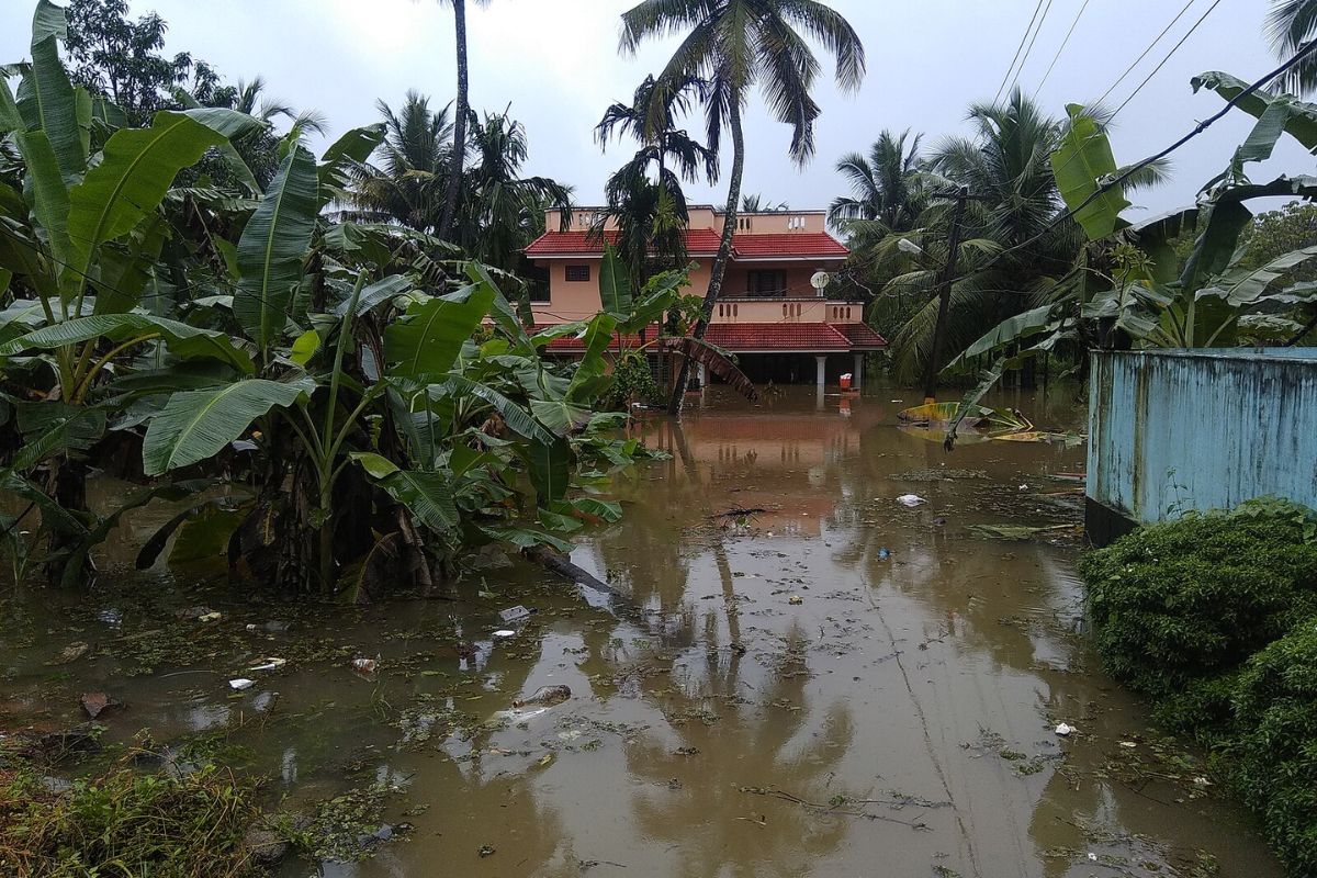
A flood the size Kerala saw in 2018 was once treated as rare. Engineers called it a 150-year event. A new study says such a flood could now hit every 25 years.
Researchers from TKM College of Engineering in Kollam analysed four decades of river flow data and found that Kerala’s current flood models underestimate real flood risk by up to 40%. The study warns that bridges, dams, and drainage systems across the state remain vulnerable as climate change intensifies rainfall patterns.
Kerala floods now more frequent
Professor Adarsh S, head of the civil engineering department at TKM College of Engineering, led the research team. The study examined flood discharge records from 1980 to 2019 provided by the Irrigation Design and Research Board.
“Our infrastructure was built on the assumption that climate change would not occur, that climatic events such as temperature and lunar cycles would remain the same. But that isn’t the truth. Our bridges, dams, and drainage systems are in jeopardy as their capacity to handle sudden downpours is limited,” Professor Adarsh said.
The research team used non-stationary flood frequency analysis, a method that accounts for climate variability linked to El Nino, the Indian Ocean Dipole, and the North Atlantic Oscillation. This approach differs from traditional models that assume stable climate conditions over time.
The findings reveal dramatic changes in flood return periods across multiple monitoring stations. At Muvattupuzha station, the 2018 flood discharge of 2,412 cubic metres per second was originally estimated to occur once in 150 years. The new analysis shows this level of flooding now has a return period of just 25 years.
At Thodupuzha, what was previously calculated as a 62-year flood event is now expected every 25 years. The shift is even more pronounced at Kakkadassery, where a 75-year event now has a return period of only 12 years.
The study also projects that flood magnitudes could increase by 29 to 40% when climate change vulnerability is factored into calculations. This means future floods could deliver significantly higher water volumes than current infrastructure was designed to handle.
Kerala’s infrastructure unfit for new rains
Kerala’s vulnerability stems from its unique geographic and climatic conditions. The state receives over 80% of its annual rainfall during just four months of monsoon season. It has experienced major flooding in 2018, 2019, 2020, and 2024, demonstrating an increasing pattern of intensity and frequency.
The 2018 floods affected 13 out of Kerala’s 14 districts, increasing August rainfall by 164% and resulting in over 400 deaths. Nearly all major river basins experienced unprecedented water levels. The disaster exposed weaknesses in reservoir management when 35 out of 54 dams had to release water simultaneously.
From Thiruvananthapuram to Kochi, waterlogging has become routine even after moderate rainfall. According to the study, this occurs because Kerala’s drainage network, culverts, and bridges were designed using flood maps that no longer reflect current rainfall patterns.
The research identifies a critical gap between infrastructure capacity and climate reality. Current design standards for dams, bridges, and drainage systems do not account for the changing frequency and intensity of extreme rainfall events.
The study warns that unless design standards are urgently updated, even routine monsoon spells could trigger severe flooding across both urban and rural regions. Towns and cities now experience flooding after rainfall that would previously have been considered moderate.
Professor Adarsh worked with research scholar Meera G Mohan on the project. The research received support from the Core Research Grant under the Department of Science and Technology’s Science and Engineering Research Board.
Outdated systems amplify Kerala floods
Kerala consists of 14 districts with varied topography, from the Western Ghats highlands to low-lying coastal areas. The state contains 44 major monsoon-fed rivers, making it highly vulnerable to flooding during heavy rainfall periods.
The research highlights that Kerala’s current flood management approaches struggle to keep pace with increasing flood magnitude and frequency. Factors such as outdated infrastructure, uncoordinated dam management, and poor urban planning have worsened the impacts of recent flooding events.
The study emphasises the urgent need to revise infrastructure design standards to reflect current and projected climate conditions. Without these updates, Kerala faces mounting risks to lives, property, and critical infrastructure during future monsoon seasons.
Support us to keep independent environmental journalism alive in India.
Keep Reading
Elephants Are Back in MP After a Century, But Can They Stay?
Solar Energy – A Paradigm Shift in Wildlife Conservation
Stay connected with Ground Report for underreported environmental stories.