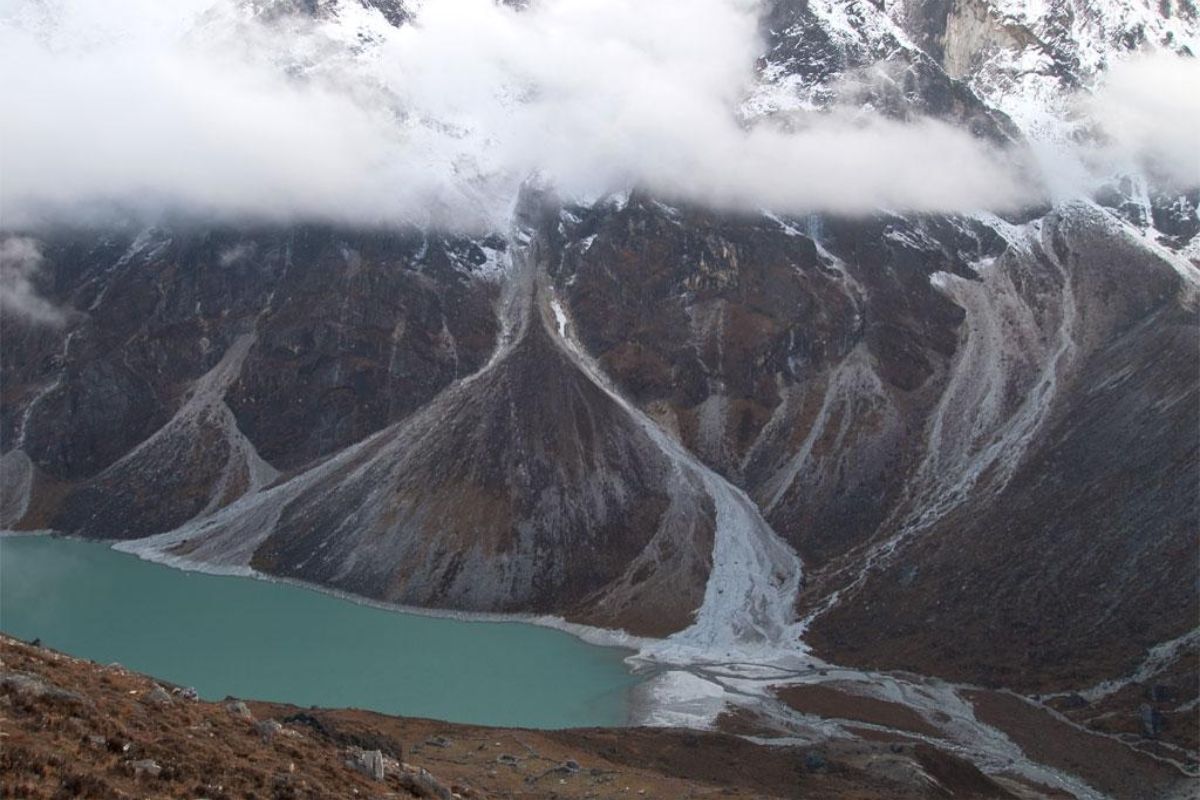
Glacial lakes originate from trapped meltwater behind natural barriers such as glacial ice, bedrock, or moraines (terminal moraines are unconsolidated debris piles at a glacier’s furthest point). When these barriers fail, the abrupt discharge of a substantial water volume triggers an outburst flood, causing devastating impacts on downstream environments and communities. Climate change accelerates this risk by melting glaciers, resulting in larger and more frequent lakes.
Quakes trigger lake flooding risk
Frequently, earthquakes have been linked to the initiation of glacial lake outbursts by compromising the structural integrity of the dam. This seismic activity can also induce instability in nearby slopes, leading to rock avalanches that displace water from the dam, causing it to overflow.
However, a recent study in Geophysical Research Letters challenges this notion, proposing that the triggering mechanisms may involve more intricate processes than previously thought.
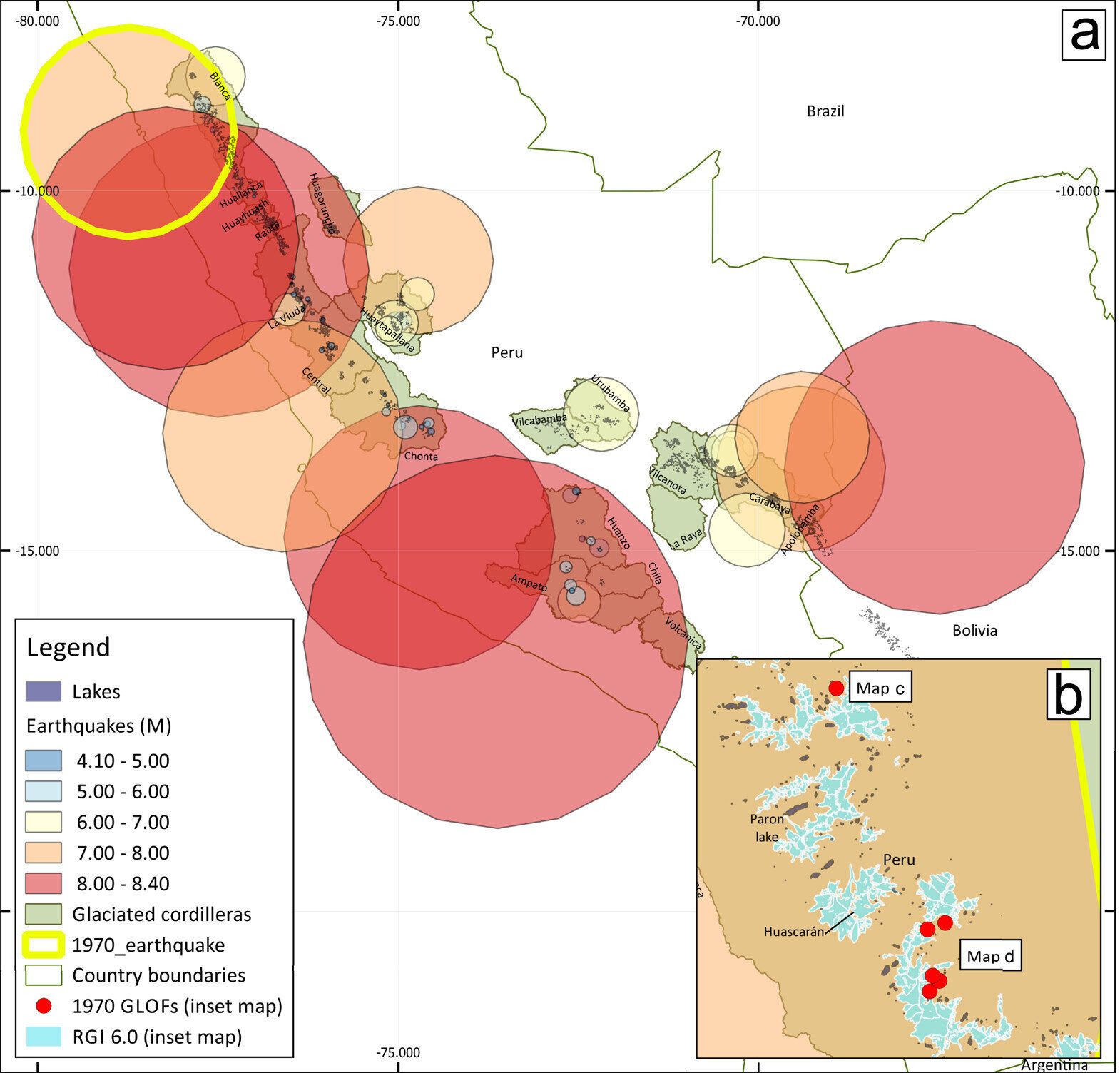
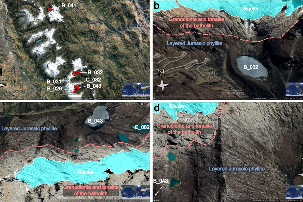
Dr. Joanne Wood, alongside colleagues from the University of Exeter, conducted a study on glacial lakes in the tropical Peruvian and Bolivian Andes of South America, examining the history of outburst events linked to earthquakes. Their investigation revealed that out of 59 earthquakes recorded between 1900 and 2021 near glacial lakes, only one led to a flood event.
Despite the widespread assumption of a causal link between seismic activity and lake destabilization leading to catastrophic flooding, the study found limited empirical support for this notion. Only 11 outburst events worldwide have been confidently linked to earthquakes, with six attributed to a magnitude 7.9 earthquake in Peru’s Cordillera Blanca mountain range in May 1970, primarily affecting glacier-fed lakes.
To further investigate this, the research team analyzed data from the United States Geological Survey, identifying 11,733 earthquakes of magnitude greater than four and 67 documented outburst floods in glacier-fed lakes since the early 1900s.
Floods categorized by seismic timing
As per the study, these flood events were categorized into four groups to assess the temporal relationship with seismic activity: occurring on the same day as the earthquake, within a month, within six months, or a year.
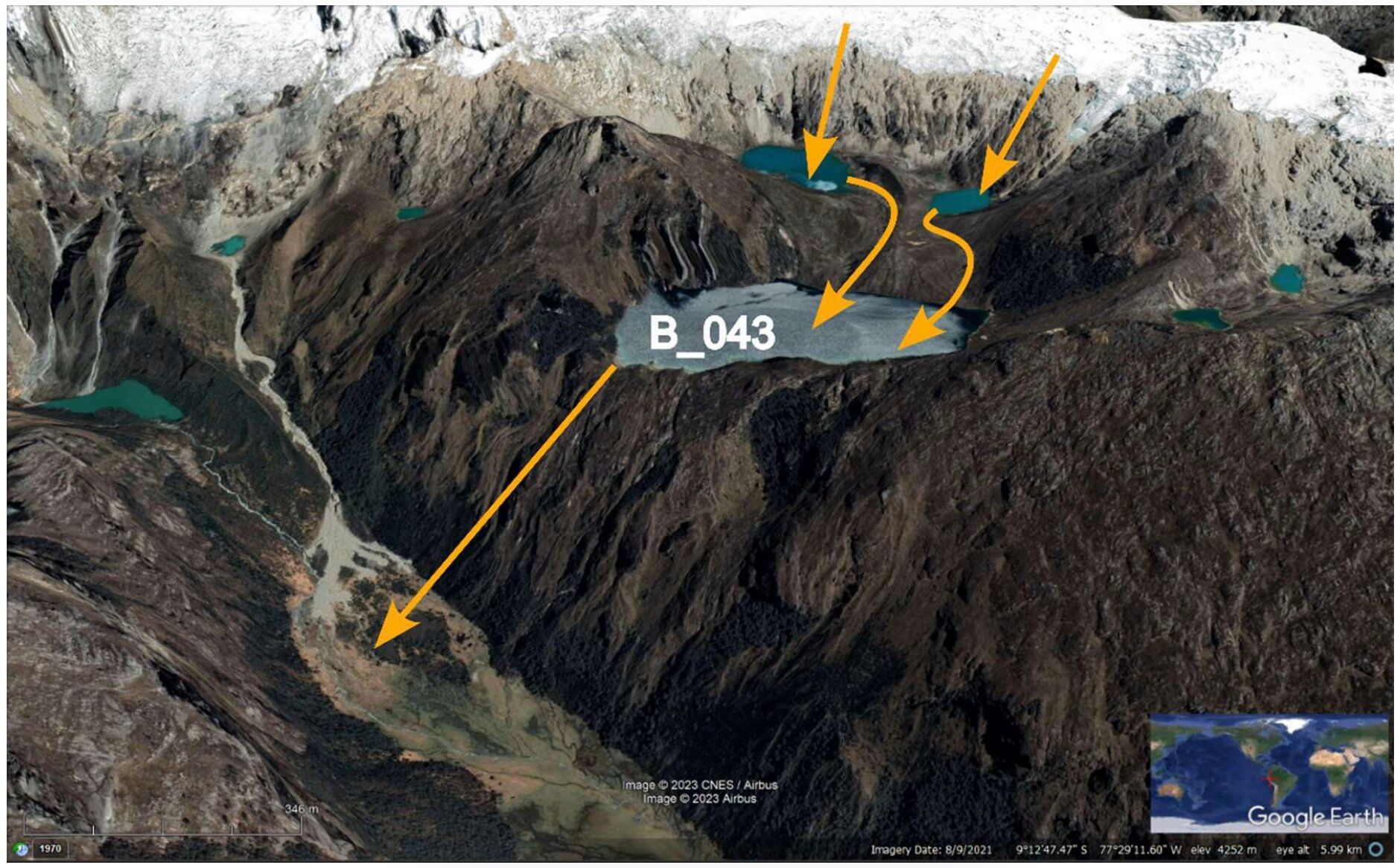
Utilizing this dataset, scientists examined four earthquake-associated processes to elucidate why glacier-formed lakes, apart from the anomaly in 1970, did not flood. The incidence of moraines due to landslides is on the rise, with five out of the six eruptive floods triggered by mass activity, as observed in the 1970 event. However, researchers propose that the smaller size of glacier-formed lakes may limit their capacity to release water compared to river-blocking systems.
Seismic shocks disrupt moraines, with seismic waves dissipating upon reaching the valley floor where glacier lakes form. Surface waves may be obstructed by topography, resulting in reduced shock impact on moraines. This diminished shock effect decreases the likelihood of moraine collapse, and even minor movements can compact sediments, enhancing stability by reducing porosity and permeability.
Scientists studied why earthquakes didn’t cause floods
-
Landslides triggering moraine overtopping: In the 1970 event, five out of six outburst floods were initiated by mass movements. However, Dr. Wood and colleagues propose that the smaller size of glacial lakes may limit water displacement compared to obstructing a river system.
-
Shaking disturbs moraines: Seismic body waves (P and S waves) dissipate upon reaching valley floors with glacier lakes, while surface waves may encounter topographic barriers. This reduced shaking reaching moraines decreases collapse risks, and minor movements can even enhance stability by compacting sediments.
-
Liquefaction: Loosely consolidated, water-saturated sediments are prone to liquefaction, causing the ground surface to weaken and structures to sink. Susceptible sediments include coarse silt, fine sand, and gravel, generally smaller than those forming dam moraines.
-
Faulting: Glacier lake dams typically lack major faults running through them, minimizing points of failure and drainage initiation. If faults intersect the lake, they often remain concealed below the surface.
Revisiting the 1970 anomaly, the researchers proposed that the earthquake triggered the displacement of thousands of rocks and mud into lakes within the three valleys, particularly affecting deeply weathered granitoids destabilized by frost wedging. This process involves water seeping into cracks, freezing, and expanding, thereby exacerbating the cracks.
Beyond the theory of drainage, and the fact that these lakes, like the rest of Peru, are blocked by rock – mostly moraines rather than lakes – is precisely why the flood that followed the 1970 eruption of a glacier-fed lake was so devastating, For which further investigation is necessary.
However, this research is important because it challenges the concept of earthquakes as the major cause of outbursts of glacial lakes and suggests that determining the initial cause may help in assessing the risk. More research needs to be done. So that the impacts on the local environment, infrastructure and people can be reduced.
Keep Reading
Part 1: Cloudburst in Ganderbal’s Padabal village & unfulfilled promises
India braces for intense 2024 monsoon amid recent deadly weather trends
Support us to keep independent environmental journalism alive in India.
Follow Ground Report on X, Instagram and Facebook for environmental and underreported stories from the margins. Give us feedback on our email id greport2018@gmail.com.
Don’t forget to Subscribe to our weekly newsletter, Join our community on WhatsApp, and Follow our YouTube Channel for video stories.