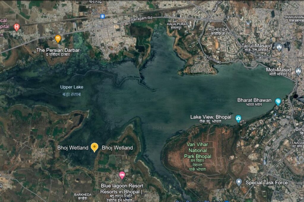
The scientists at the Indian Institutes of Science Education and Research (IISER) Bhopal and Maulana Azad National Institute of Technology (MANIT) spent fifteen months developing an artificial intelligence model to monitor and reconstruct decades of missing satellite data and predict the future of Upper Lake, also called Bhojtal Wetlands, in Bhopal.
Using the model, the research team led by Roshan Nath and including Dr. Somil Swarnkar, Dr. Vikas Poonia, and Dr. Vinod Kurmi found that if global temperatures rise by two degrees Celsius, the threshold set by the 2015 Paris Agreement, the Upper Lake could shrink by up to 40 percent during pre-monsoon dry spells.
Seasonal water levels would swing more violently. “The lake faces more frequent dry spells and weaker recharges,” Dr. Somil Swarnkar, a member of the research team, told Ground Report.

Dr. Lokendra Thakkar, officer in charge of the Madhya Pradesh State Wetlands Authority, said, “We appreciate it as a valuable piece of research, especially its use of AI-based tools,” Thakkar told Ground Report.
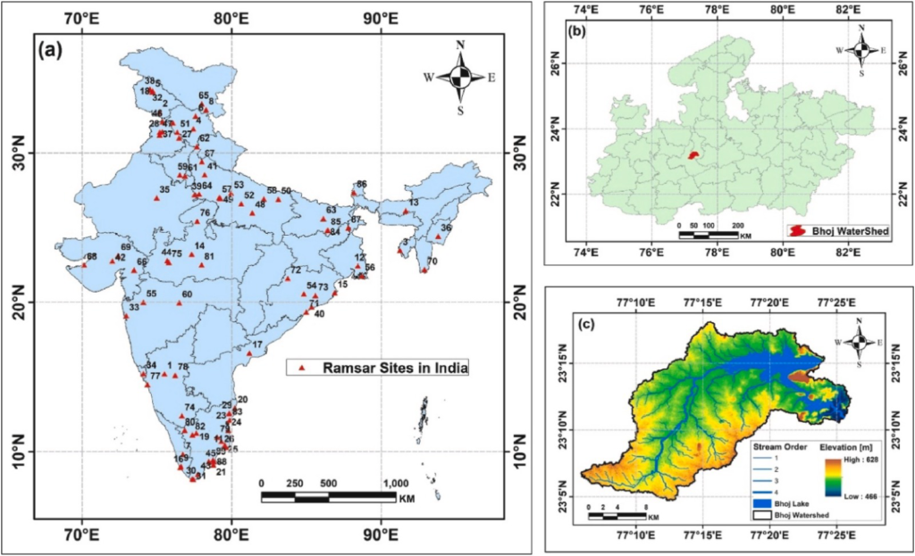
This man-made lake, a designated Ramsar site since 2002, serves almost 1.8 million people and 40 percent of Bhopal’s drinking water needs.
What the AI Actually Does
The research was based on Landsat satellite imagery covering Bhojtal from 1990 to 2022.
“Satellite imaging often results in data gaps due to cloud cover or technical constraints,” said Dr. Swarnkar. “This makes it challenging to record pond water levels.”
Apart from cloud cover, there were other issues. A scan line corrector failure in Landsat 7, a broken part that kept satellite image strips aligned, left every image taken after 2003 with jagged gaps running through them. Sensor limitations meant the satellite could not capture usable data at all during certain months. Together, these problems created striping errors and blank stretches across years of data. Nearly 40 percent of the original images were classified as poor quality or unusable.
The team developed an AI model to fix this gap.
Dr. Swarnkar explained the model in simple terms. “… we have multiple data points containing water surface values. We link those values to the rainfall of that month or to the rainfall three months prior. If rainfall decreased three months prior, the lake’s surface area will undoubtedly decrease. If temperature increases in a particular month, the surface area will undoubtedly also decrease.”
The model connects four climate variables to the lake’s surface area: rainfall, temperature, evaporation, and soil moisture. It learns from historical data how these variables relate to the lake’s size.
“Many relationships in nature are compounding,” Dr. Swarnkar said. “AI can explain and predict rainfall and temperature effects very well, better than the governing equations provided by physics-based models, because it incorporates nonlinear interactions, randomness, and everything together.”
The team used two AI tools in sequence. The first, a feed-forward neural network, filled the missing months. It was trained on 259 valid observations, then used to reconstruct 125 missing monthly values.
“With the help of our first deep learning model, we can fill data gaps up to a certain extent,” Dr. Swarnkar said. “Once that data gap is filled, we can make time series predictions.”
The team took existing frameworks and trained them on Bhojtal Lake data for the first time in India.
Like how engineers developed Microsoft Word, and we use it for writing and drafting. Dr. Swarnkar explained, “In the same way, the LSTM model was developed abroad by Sepp Hochreiter and Jürgen Schmidhuber in 1997, but we built our own framework specifically for this lake.”
Roshan Nath, who led the technical work and is co-author of the research paper, said the same. “The model already existed, but nobody had trained it this way before. The model we trained on Bhojtal Lake is new,” he said.
The second tool, a Long Short-Term Memory model, or LSTM, was built for prediction. It is a sequential learning model trained on the reconstructed record. The team then ran the LSTM forward using climate projections for a world two degrees warmer.
The combined framework achieved about 90 percent accuracy against historical observations. “The model carries an error of 2.1 square kilometers, meaning predictions could occasionally overshoot or undershoot by that margin, but with 90 percent accuracy overall, the framework captures the broad patterns reliably,” Dr. Swarnkar said. “The main reason is our satellite-derived dataset. Even within that, we still have gaps that haven’t been filled.”
Scientists around the world use AI to study water. In the United States, researchers used LSTM to track temperatures in the Great Lakes. In China, scientists used it to monitor water levels in Dongting Lake. In Hungary, researchers used it to forecast river levels. In India, a team from Sri Sairam Institute in Chennai used a similar model to track changes in water bodies across the country using satellite images.
But no study used satellite climate data, rainfall, temperature, evaporation, and soil moisture to predict how much a specific lake would shrink in a warmer future. “I did not find any literature regarding this,” Nath said. “Nobody has done this kind of training using satellite-derived climate data to get the water surface area.”
Water Quality, Climate Pressures
“At present, with this model, we can predict the surface area completely,” Dr. Swarnkar said. “The second aspect, water quality, AI tools can be made for that too. But we need a higher-quality dataset. If we have continuous data records and measurements, then four to five years down the line, we will be able to generate such models that can help us find out the pattern of how it is evolving.”
Though there is knowledge about the quality of Bhojtal’s water, a government audit found that Upper Lake contains between 1,480 and 2,050 microplastic particles per cubic meter. The lake receives a daily sewage inflow of around 44 million liters. These microplastics include fibers and fragments small enough to enter the food chain through fish and birds.
Before 1947, Upper Lake water was considered so clean that it required no treatment at all. Over time, rapid population growth and human activity increased pressure on the lake. Pollution, sewage inflow, and runoff have degraded water quality to the point where extensive treatment is now essential.
The model can separate what the climate is doing to the lake from what humans are doing to it. “I will turn off the human factor and only vary the climate factor,” Dr. Swarnkar explained.
Between 1995 and 2005, the MP government implemented the Bhoj Wetland Conservation Project, partly funded by the Japan Bank for International Cooperation (JBIC). Despite this, researchers note little improvement in water levels and overall water quality.
The new model can now help identify which actions worked and which did not, giving policymakers a clearer way to target future interventions. “If we can find out where we should keep our monitoring and where we have to manage hotspots, then there are high chances we will be able to do very good work in the direction of conservation,” Dr. Swarnkar said.
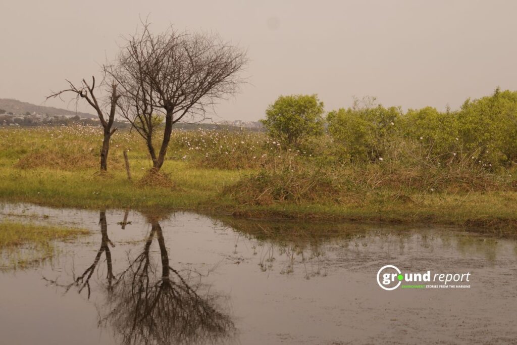
A separate study found that settlements around Bhojtal have nearly doubled in the past decade, with many built in high flood-risk areas. This growth has reduced core wetland areas and increased pressure on the lake.
Saurabh Popli, a landscape planner and associate professor at the School of Planning and Architecture, said this pattern reflects how cities are planned across India. “Planning has largely followed one-size-fits-all ideas, even though climates and local conditions differ sharply,” he said.
Dr. Swarnkar put it simply, “Water security defines our era. Cities can now turn predictions into action before lakes run dry.”
In 2019, severe drought conditions developed, and the lake fell to about 60 percent below its normal level. Dr. Swarnkar recalled speaking to Bhopal residents who described flying kites inside the empty basin.
“Droughts are predictable. Our aquifers are drying up. In South Africa, in Chennai, there are cities where groundwater is about to reach zero,” Popli said such crises are foreseeable and not unique to Bhopal. “There is no coordination between science, policy, and planning practice today,” he told Ground Report.
What Two Degrees Does to the Lake
“When the temperature increases by plus two degrees, 40 to 50 percent of surface water will decrease in the summer period,” Dr. Swarnkar said. “If the temperature increases, evaporation will increase, there will be water loss from the lake, and there will be changes in the rainfall pattern.”
Thakkar said the State Wetland Authority already works with institutions like IITs, IISER, and the Indian Institute of Soil Sciences (IISS), Bhopal, to bring science into policy.
“We have commissioned a project to develop an AI-based, real-time monitoring system for five Ramsar sites in the state, including Bhoj Wetland,” Thakkar said. The project has been assigned to MPSEDC, the IT arm of the state government.
The same model logic applies to glacier lakes in the Himalayas, where snowmelt is accelerating and glacial outburst flood risk is rising. It works wherever satellite data exists, and ground-level measurements are scarce. The researchers say this model can be adapted for all Ramsar sites.
Thakkar acknowledged a wider challenge: “Wetlands are sectoral issues. Nearly ten to twelve departments and a dozen laws govern them, which makes coordination difficult.” He added that citizen behavior matters as much as policy. “Effective wetland protection depends on both law-abiding citizens and accountable enforcement,” Thakkar said.
Shishir Agarwal contributed to this report.
More Ground Reports
What does Ramsar status actually change for Bihar’s wetlands?
MP Poshan Aahar Closures Put Rural Women’s Livelihoods at Risk