The India Meteorological Department (IMD) announced in its latest update on X (formerly Twitter) on Tuesday that Cyclone ‘Hamoon’ has intensified into a very severe cyclonic storm, and it currently lies close to Odisha, West Bengal, and Bangladesh. They reported that the cyclonic storm currently lies approximately 290 km from Paradip in Odisha, 270 km from Digha in West Bengal, and 230 km south-southwest of Khepupara in Bangladesh.
Experts expect Cyclone Hamoon to cause light to moderate rainfall in many northeastern states of India, including: Manipur, Mizoram, Tripura, Meghalaya, South Assam. They predict that the cyclone will cause heavier downpours in Mizoram on October 24 and even more intense rainfall in Tripura. They expect the rainfall intensity to decrease on October 26.
The storm will land on the Bangladesh coast between Khepupara and Chittagong as a deep depression on October 25, 2023. Meanwhile, the weather agency has issued rain alerts in seven states that the cyclone will impact.
The warnings reveal that rain is likely to occur at most places in the northeastern states of Manipur, Mizoram, Tripura, Meghalaya, and south Assam from Oct 24-26. They expect heavy rainfall in Mizoram on October 24, and they anticipate even heavier showers in Tripura. The warnings predict that heavy rain will likely continue in the regions on October 25, decreasing by October 26, with only light to moderate rainfall at a few places.
The cyclone intensified into a deep depression on October 22, and into a cyclonic storm on October 23. It reached its peak intensity on October 24, with sustained winds of 62 km/h (39 mph) and gusts of 88 km/h (55 mph).
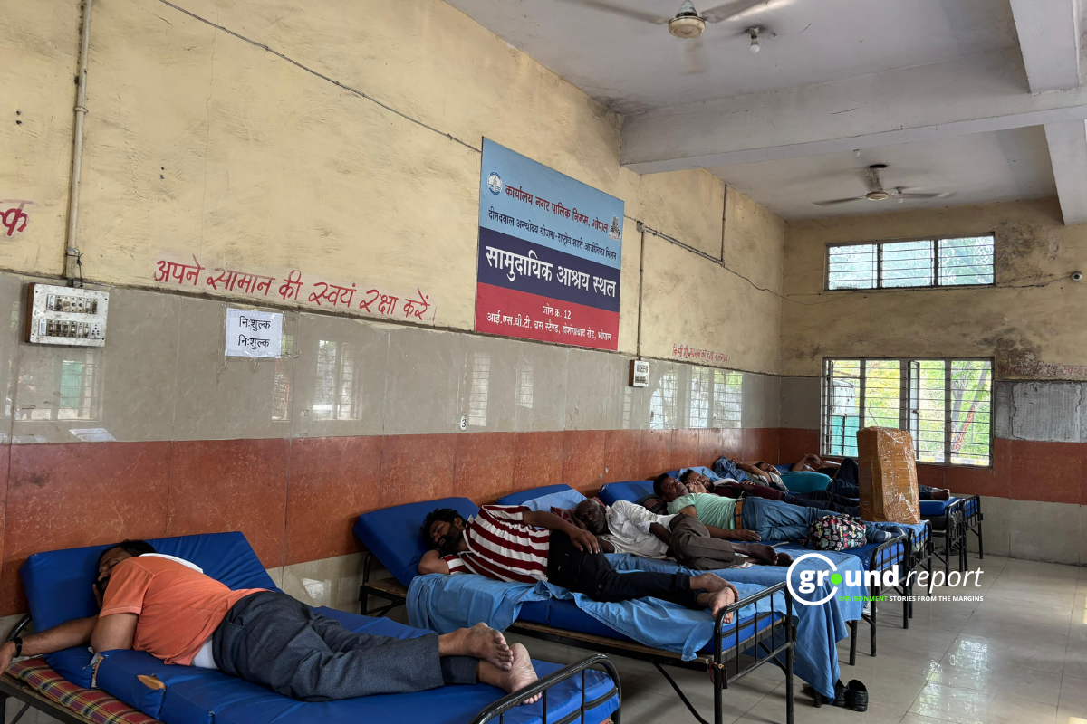
IMD rain alert, fishermen warning till October 25
The weather office has issued a rain alert for seven states till October 25 due to cyclonic conditions. US Dash, a Weather scientist, told PTI news agency that the cyclone will travel 200 kms over the sea from the Odisha coast. He also mentioned that coastal Odisha would likely receive light to moderate rainfall at a few places over the next two days.
Odisha has already received rainfall in its coastal areas and showers are likely to continue on Tuesday too. Heavy rainfall might occur in areas like Bhadrak, Kendrapada and Jagatsinghpur on Tuesday.
The IMD has warned fishermen not to venture into eastcentral and north Bay of Bengal, and along the coasts of Odisha, West Bengal, Bangladesh, and north Myanmar on Oct 24-25. The IMD stated in its bulletin that the sea conditions across the Bay of Bengal will be high to very high on Oct 24 and Oct 25.
Keep Reading
- UAE is using bots to get support on COP28
- How UAE is making the Cop28 climate summit a joke?
- Everything We Know About COP 28 in Dubai This Year
- India urgently requires $50-100 billion for climate financing: Experts
Follow Ground Report for Climate Change and Under-Reported issues in India. Connect with us on Facebook, Twitter, Koo App, Instagram, Whatsapp and YouTube. Write us on GReport2018@gmail.com.